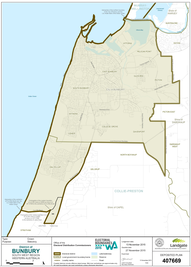
The electorate of Bunbury is located in the South West Region and includes all or parts of the City of Bunbury and the Shire of Capel. Comprising of all or parts of the localities of Bunbury, Carey Park, College Grove, Dalyellup, Davenport, East Bunbury, Glen Iris, Pelican Point, Picton, South Bunbury, Usher, Vittoria, and Withers.
Enrolment (2017) 27,943; 82 sq kms.
Nomenclature: Bunbury is named in honour of Lieutenant Henry William St. Pierre Bunbury (1812-1875) of the 21st Fusiliers. Bunbury carried out explorations in this area in 1836, and in a book of his letters and papers published in 1930 he wrote of Bunbury " A township has been formed, or at least laid down on the maps, comprising the southern promontory and part of the north beach at the entrance of Port Leschenault Inlet, which the Governor named "Bunbury" in compliment to me ..." In 1830 Lt Governor Stirling caused a military station to be established at Port Leschenault under the command of Lt McLeod, but it only lasted six months. Bunbury township was mentioned in the Government Gazette in 1839, but lots in the town were not surveyed until 1841, and these were declared open for selection in March 1841.
(Source: Western Australia. Department of Land Administration. Names and Places.)